Mount Agung
Mount Agung or Gunung Agung is a volcano in Bali in Indonesia, located south east of Mt Batur volcano, also in Bali. Gunung Agung stratovolcano is the highest point on Bali. It dominates the surrounding area, influencing the climate, especially rainfall patterns.
Balinese believe that Mt Agung is a replica of Mt Meru, the central axis of the universe. One legend holds it that the mountain is a fragment of Meru brought to Bali by the first Hindus. The most important temple on Bali, Pura Besakih, is located high on the slopes of Gunung Agung.[4]Gunung Agung last erupted in 1963–1964. It is still active with a large and very deep crater which occasionally belches smoke and ash. From a distance, the mountain appears to be perfectly conical.
From the peak of the mountain, it is possible to see the peak of Mt Rinjani on the nearby island of Lombok, to the east, although both mountains are frequently covered in clouds.
From the peak of the mountain, it is possible to see the peak of Mt Rinjani on the nearby island of Lombok, to the east, although both mountains are frequently covered in clouds.
ndonesian authorities have raised the alert level for Mount Agung volcano in Balito its highest degree after a surge in seismic activity around the mountain sparked fears of an eruption.
Approximately 10,000 villagers had left their homes around the volcano, officials said. It was the third time in little more than a week that the alert level had been raised.
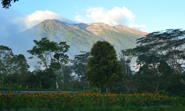 |
There is growing concern that Mount Agung could erupt for the first time in more than 50 years. Photograph: AFP/Getty
|


Komentar
Posting Komentar